



Trailers, containers, implements, generators and hired equipment share one property that decides everything about their tracking: there is no vehicle battery to live off. Once a tracker cannot draw from the chassis, every design choice collapses into a single trade — how often it reports, against how long it must survive on its own cell.
We get called in after the first battery dies or the first asset goes missing between two reports, so this is written as the selection conversation we wish happened earlier: what the battery maths actually says, what accuracy the decision needs, and where battery-powered units quietly underperform wired ones.
GNSS Asset Tracker Battery Life: The Arithmetic That Decides It
The plain-language version: battery capacity is nearly irrelevant; duty cycle is everything. A tracker spends most of its life asleep, and the ratio between sleep current and working current is what turns a small cell into months of service — or a large one into a weekly charging chore.
Take real numbers from two units in this family. A compact tag with a 2500 mAh battery and a working current around 200 mA runs about twelve hours if it never sleeps; the same unit idling at roughly 3 mA stretches to over a month. Multiply any percentage of time spent awake and the arithmetic moves just as fast in the other direction. A larger portable unit with a 4000 mAh cell is quoted at 18–20 hours while reporting at 1 Hz in real time — a live-tracking profile, not an asset profile. Neither figure is wrong; they answer different questions, and the mistake is buying on the bigger number.
| Reporting strategy | What it costs | Fits |
|---|---|---|
| Hourly heartbeat | Weeks to months per charge | Stored implements, seasonal equipment, long idle assets |
| Movement-triggered | Sleep current dominates; depends on how often it moves | Trailers, containers, hired equipment in normal use |
| 1 Hz live tracking | Hours, not months (18–20 h on a 4000 mAh unit) | Active recovery operations, high-value escorted moves |
The question to put to any supplier is therefore not "how big is the battery" but "what is the sleep current, and what does one day of my duty cycle consume". If the answer is a capacity figure alone, the unit was designed for vehicles, and it will disappoint on an unpowered asset.
Accuracy: Match It to the Decision the Data Has to Support
Before looking at a single specification, write down the decision each report has to support. Most asset questions are yard-level: which depot is it in, did it leave the yard, which row of the compound is it parked in. For those, the 2.5 m single-point accuracy of a standard cellular tracker is genuinely enough — fences and yard boundaries are tens of metres apart.
Accuracy earns its cost when reports must support a handover or a dispute: which bay did the container stop at, did the implement return to the same corner, where exactly was the asset when the alarm fired. That is the tier where an RTK tracker changes the conversation — roughly 1 cm horizontal under differential corrections, against about 1.5 m standalone on the same hardware. And inside a depot building or under a roof, where satellites stop, a short-range layer such as UWB at around half a metre is what keeps the last metres honest.
The misallocation we see most is the reverse: paying for centimetre accuracy on assets that only ever need to be found in a yard, while running a 2.5 m unit on the one asset whose movements are contractually disputed. Budget follows the dispute, not the fleet average.
Coverage Gaps: What Happens Between Reports
Unpowered assets live in the worst RF real estate a fleet owns: inside steel containers, under tarps, in the back corner of a depot, behind a warehouse wall. A tracker that only speaks when GNSS and 4G both agree will go quiet exactly when it matters.
Three mechanisms cover the gap, and they are worth checking line by line. Positioning fallback: units that add cell-tower positioning (LBS) alongside the satellite fix still produce a coarse position from inside a container — wrong by a few hundred metres, but the difference between "somewhere in the port" and no answer at all. Offline buffering: a unit that stores over a thousand positions and retransmits them when coverage returns turns a dead zone into a delayed answer instead of a hole. Geofencing on the device itself: dozens of fences evaluated locally mean the exit alert fires even if the cloud platform was unreachable at that moment — this is standard on wired vehicle trackers, and it is a reasonable expectation to carry across to battery units too.
One related point from the recovery side: when an asset is confirmed missing, the tracking profile changes. The heartbeat is switched to live, and the battery that lasted months at rest will now run down in hours. That is the correct use of the live mode — planned, short, and with the recovery team already moving.
Environment and Network: The Two Silent Failures
Battery trackers fail quietly in two ways that never appear in a demo, and both are checkable on a datasheet.
Ingress protection first. A unit on a trailer drawbar eats pressure washing, mud and salt; IP66 on a flat tag or an IP54 rating on a larger portable case are not interchangeable with "waterproof" in a sales conversation. Temperature matters just as much: equipment stored through a continental winter or a gulf summer sees the extremes of the operating range, and a cell that underperforms at −20 °C shrinks every runtime estimate made at room temperature.
Network bands second. A tracker bought for one region can be mute in another; the frequency list (B1/B3/B5/B7/B8/B20/B28 and so on) decides where the unit works, and mixed fleets crossing borders need the union of those lists, not the midpoint. Where assets sit in refinery, chemical or mining environments, certification — explosion-proof support, for example — is a gating requirement, not an option. And on units carried by people rather than bolted to frames, an SOS button with preset contacts has quietly become part of the requirement list.
Two Units That Cover the Two Common Cases
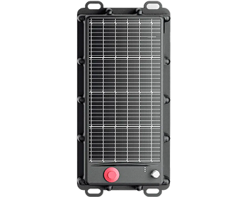
Between the yard-level tags and the live-recovery units, most unpowered fleets settle on a two-tier setup. Both parts below are battery-first designs; they differ in where they sit on the accuracy-versus-runtime line.
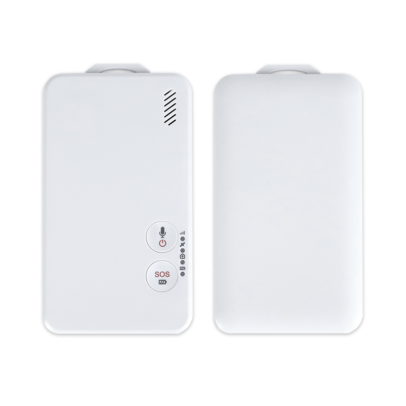
P7 — RTK Asset Tag
- Dual-frequency GNSS; RTK 1.0 cm ± 1 ppm
- UWB ≤50 cm indoors; BLE ≤5 m
- 2500 mAh; standby ≤3 mA, working ≤200 mA
- IP66, 127 × 67 × 12 mm, 116 g, contact + Type-C charging
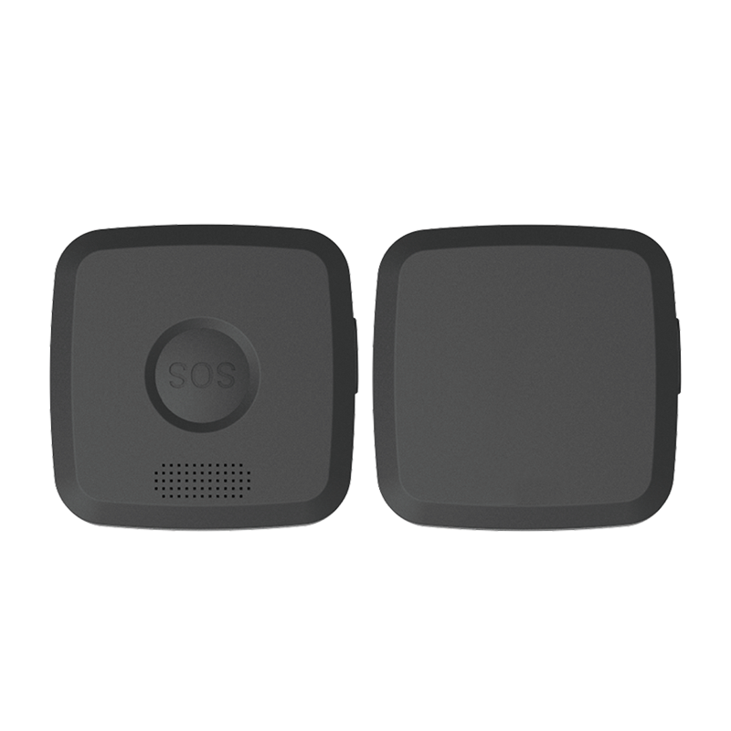
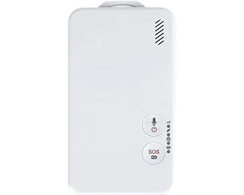
P9 — Compact Tracker
- GPS/QZSS + GLONASS + SBAS, ~5 m single point
- Global 4G bands B1/3/5/7/8/20/28
- SOS call to 3 contacts; SMS remote config; OTA
- IP65, 43 × 43 × 12 mm, 25 g
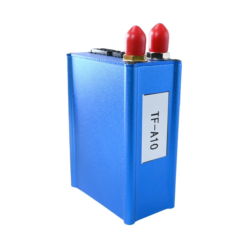
For the tier above, the P16 adds differential RTK (static 2 cm, dynamic under 10 cm), LBS fallback and a 1 W light with SOS on a 4000 mAh portable case; where the asset has a power feed after all, a wired unit such as the A10 removes the battery question entirely and contributes device-side geofences and 1500-record offline storage. The families are listed under asset trackers and vehicle GNSS trackers.
How to Pilot One Unit Before the Fleet Order
A datasheet review cannot settle a duty-cycle question, but three weeks with a single unit can. The pilot costs almost nothing and has retired more purchase-order mistakes than any comparison table.
- Run one honest week of reporting. Fit the unit to a representative asset, set the intended reporting profile, and log the actual battery curve — not the first day, which is unrepresentative, but a full week including the weekend the asset sits still. Extrapolate from the measured slope, not the specification.
- Walk the dead zones deliberately. Take the asset through every place it actually lives: the container, the tarp corner, the far end of the depot. Note where the report is late, where it is tower-fixed, and where it buffers. This is the coverage answer for your site, and no network coverage map substitutes for it.
- Test the mount, not just the tracker. Vibration on a drawbar, salt spray at a port, a pressure wash at the depot — the mounting point decides whether the ingress rating survives the first season. Check the fix after every wash and after the first hot week.
The pilot also surfaces the platform half of the decision: how alerts reach people, whether the geofence reports arrive late, and who actually reads the dashboard. Those answers belong in the selection as much as the hardware, because a tracker nobody monitors is a brick with a SIM card.
Questions Buyers Ask Most Often
How long will the battery actually last?
Somewhere between the two datasheet numbers, and your duty cycle picks the point. Continuous live reporting is measured in hours; pure standby is measured in weeks; movement-triggered reporting lands in between and depends on how often the asset moves. Ask for sleep current and model one honest week of your operation — that answer will be better than any single quoted figure.
Do unpowered assets really need RTK accuracy?
Usually not, and mostly at yard scale 2.5 m is enough. RTK on a battery tracker earns its keep where reports support a handover, a charging bay or a contractual dispute — and it is priced accordingly. Buy the accuracy the dispute needs.
What happens when the asset sits in a dead zone?
With LBS fallback you get a coarse tower fix; with offline buffering the positions taken inside the gap are stored and retransmitted on return; with device-side geofences the exit alert still fires locally. None of these arrive by accident — check them before purchase, not after the first disappearance.
Can we mix battery tags and wired trackers on one platform?
Yes, provided both speak the same protocol on the platform side — JT/T 808-based families are commonly mixed this way. The useful habit is treating them as one fleet with different reporting profiles, not as two systems with two logins.
None of this replaces a pilot on your actual yard, but it makes the GNSS asset tracker conversation specific: duty cycle first, accuracy second, coverage gaps third, and environment and bands as the gate before any purchase order. If you share what the fleet looks like and how often it moves, we will help you size the reporting profile instead of the battery.
Tracking assets that have no power feed?
Tell us the asset type, how often it actually moves, and what a report has to prove. We will match the reporting profile and accuracy tier to the decision it supports.
.png?imageMogr2/format/webp)
.png?imageMogr2/format/webp)